Thursday, August 20, 2009
Steelhead on the Hoh
Sunday, June 28, 2009
Canadian tiger swallowtail lands in my back yard
I caught a rare close-up video glimpse of a beautiful but aging Canadian tiger swallowtail butterfly, which landed on Ann's potted geraniums and voraciously grazed for nectar (June 27, 2009).
The tiger, with a wingspan between three and four inches, then hopped to the pansies.
They are lighter yellow than their larger Southern California cousins, which I used to chase down the streets of San Diego as a kid.
This tiger's tails were nearly worn off, no doubt from many miles aflutter.
They are typically spotted on Olympic Discovery Trail between Siebert and Morse creeks and grow from eggs laid on willow leaves that grow into larger greenish caterpillars, then to the chrysalis state, then hatch as butterflies.
Some research on the Web turned up some interesting facts about this lovely creature:
• It is the state insect of Oregon, the state butterfly of Georgia (eastern swallowtail).
• The eastern species is the state insect of Virginia, Alabama, South Carolina and Delaware.
• The Western tiger swallowtail migrates south from Canada to Mexico, much like the monarch.
Tuesday, June 2, 2009
One stop, two shellfish dinners
Friday, April 17, 2009
Port Townsend walking tour
Wednesday, April 15, 2009
Third Beach

Pulling from the OPtopian photo files: Third Beach on the Olympic Coast, inside Olympic National Park.
Virtual visitor center
Think of it as a virtual Olympic Peninsula visitor center.
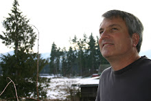
I am the smiling volunteer online, welcoming you to the region.
Like all friendly volunteers at Olympic Peninsula visitor centers, I work for free but have a wealth of knowledge and experiences to share.
My territory is bounded by Hood Canal and the Olympic Coast, east and west. The boundaries south and north run from the only temperate rain forests on the Pacific Coast, USA, to the Strait of Juan de Fuca at the Northwest U.S.-Canadian border.
Like many Peninsula residents, I love to cross the border into Victoria and Vancouver Island for a day trip, taking the Coho ferry out of Port Angeles.
If I can't come up with the answer, I will try to steer you toward the right visitor center or source.
Taking one step further, I also encourage you to share your experiences here through words, photos and videos. Make a comment or send me an email note at jchew@olypen.com.
The beauty of blogging is it's a two-way trail, an ongoing conversation.
Monday, April 13, 2009
Let me be your guide
The much greater Olympic Peninsula runs from Brinnon to Kalaloch (Hood Canal to the Pacific Coast) and from Port Townsend to Quilcene, Discover Bay, Sequim/Blyn/Dungeness Valley to Port Angeles, Joyce, Forks, Clallam Bay and Neah Bay.
While the rim of OPtopia is where most of the people live, the heart of the Peninsula is Olympic National Park and its sister park, Olympic National Forest, with more than 1,000 miles of hiking trails between them.
I moved here more than 15 years ago, finding a safe haven to raise three daughters, far from the East Bay Area of Northern California and Dallas, Texas, where I last worked at daily metro newspapers.
Today, I work for the Peninsula Daily News, which covers all the above-mentioned Olympic Peninsula communities.
I love living here. From my home I am blessed with spectacular views of Hurricane Ridge to Blue Mountain on the south and the Strait of Juan de Fuca, north to Vancouver Island, British Columbia, in Canada.
I invite you to visit the Olympic Peninsula. Have a question? Email me at jchew@olypen.com.


